Layar Monuments App for your Smartphone
„Augmented reality is a live, direct or indirect, view of a physical, real-world environment whose elements are augmented by computer-generated sensory input such as sound, video, graphics or GPS data“
„Layar is a Dutch company [that has] created a mobile browser called Layar. The browser allows users to find various items based upon augmented reality technology.“
„Raul Kern is a Wikipedian from Estonia who created a Wiki Loves Monuments layer for Layar that allows finding nearby monuments with your Smartphone.“
Raul used our global monuments database and added some creativity. The database is filled by the information from the different Wikipedia monuments lists and updated regularly. The result is a large international cultural heritage database. The more data available – especially geo coordinates – the more useful apps can be created. On the other hand, tools can help find monuments with missing images and thus be nice for participating in the photo contest. That’s what the Wiki Loves Monuments layer does.
Try it out in your region, it’s easy and fun! You need a Smartphone with the Layar augmented reality browser, and add the monuments layer to the app. Switch on the GPS functionalities and go out hunting monuments!
Have a visual impression how it works in this subtitled video:
P. S. Yes, the last monument in the video is definitely listed in Wikipedia, but sometimes GPS has its limits …
P. P. S.: the video is stored on Vimeo and subtitled via Universal subtitles If you feel like creating subtitles on Commons, I can upload an .ogv file to Commons. Just give me a sign via ew_wp[at]web.de.
Author
Read next
-
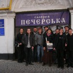
As Wiki Loves Monuments goes global this year, and there are more and more countries joining the competition, the international facilitating group is trying to help new participants to kick-start preparations in their countries. Following Lodewijk’s successful visit to the United Kingdom in February, Tomasz visited Ukraine and the Czech Republic on the weekend of […]